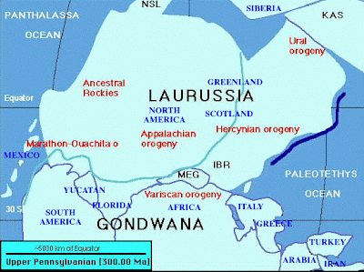
A planimetric map is a flat or horizontal representation of an area. It is different from a topographical map because it does not show relief in any detail. Rivers, lakes, mountains, forests, prairies, cities and political or other boundaries are just some of things you might find on a planimetric map. The map I have included is from the Carboniferous geological period during the Pennsylvanian Epoch when the glaciers were high, the sea low and the mountains just starting to build.


No comments:
Post a Comment