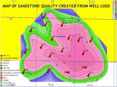
Isopachs are maps of the areal extent and thickness variation of a stratigraphic unit; used in geological exploration for oil and for underground structural analysis. In this map, the petroleum geologist contours the thickness of an individual sandstone. This sandstone is about 45 feet thick in the middle and thins to 20 feet or less around the edges of the gas field.


No comments:
Post a Comment