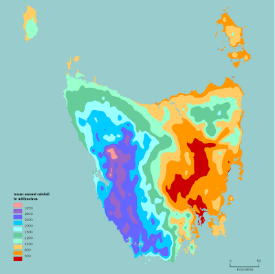
Isohyets are lines drawn on a map connecting points that receive equal amounts of rainfall. Above, the map shows the prevailing westerly airflow over Tasmania from the Southern Ocean that is generally moisture-laden. When it is forced to rise over the western, central and southern highlands, it cools and releases much of its moisture as rain (and snow). By the time the air flow gets to the eastern side of the State, it has reduced most of is moisture, and the chance of rain is reduced. Hence, there is a marked difference in average cloudiness and rainfall across the state.


No comments:
Post a Comment