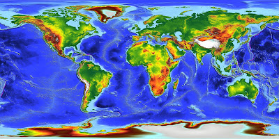
Digital Elevation Models (DLMs) are digital representations of ground surface topography or terrain. A DEM can be represented as a raster (a grid of squares) or as a triangular irregular network. DEMs are commonly built using remote sensing techniques. They may also be built from land surveying. De Montfort University generated a Global Digital Elevation Model at 30 arcseconds resolution by combining the best available ground truth with a unique global database of ERS-1 satellite altimeter derived heights, reprocessed with a novel expert system. This model, ACE, presents radically improved spatial accuracy and resolution over large regions of the globe, in particular over Africa and South America, suffering so far from a drastic lack of in situ data.


No comments:
Post a Comment