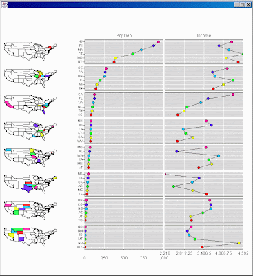
Linked micromap plots link small generalized maps with statistical panels that describe regions; for example showing county estimates on a state by state basis. The linked micromap template was specifically developed to represent spatially indexed statistical summaries. Each plot shows regional names, spatial patterns and statistical patterns while linking them all together. Thus the design is useful for communicating summaries from a host of health and environmental studies.


No comments:
Post a Comment