Public Land Survey System
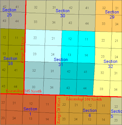 Public Land Survey System (PLSS) is a method used in the United States to identify parcels of land to and record titles and deeds of property. The basic units are township and section. Townships measure six miles on each side and are divided into 36 numbered sections of one square mile each. Each square mile equals 640 acres. In the map shown here you can see each section is subdivided into 16 equal squares of 40 acres. This gave rise to the term “lower 40” based on the location of a plot of property within that section.


No comments:
Post a Comment